Thursday, September 26, 2013

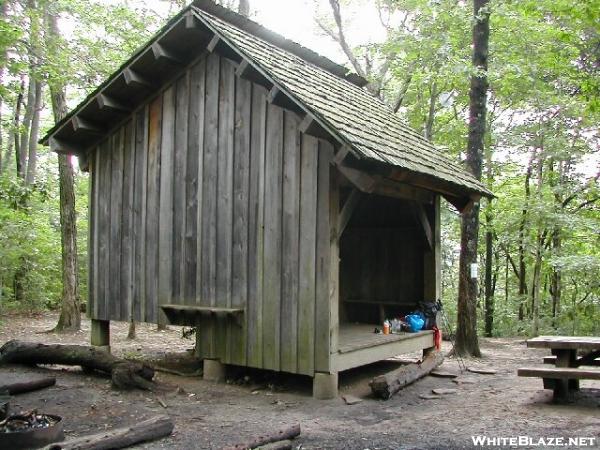
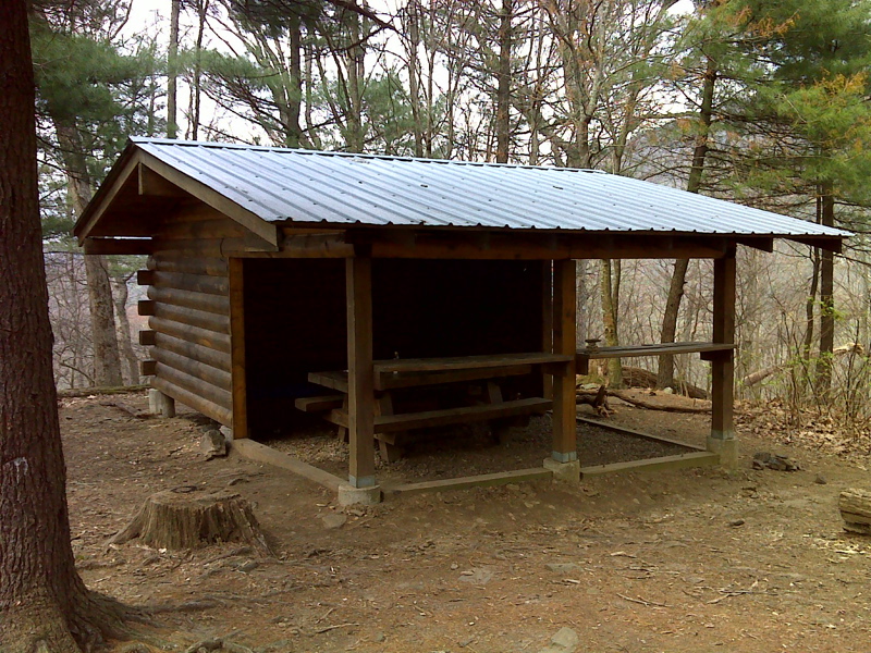
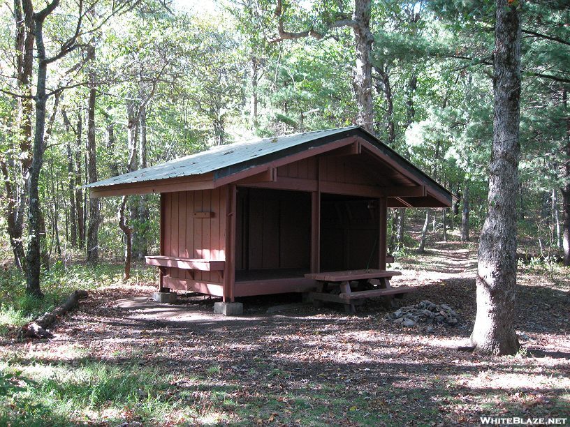
Choose your shelter in Georgia!

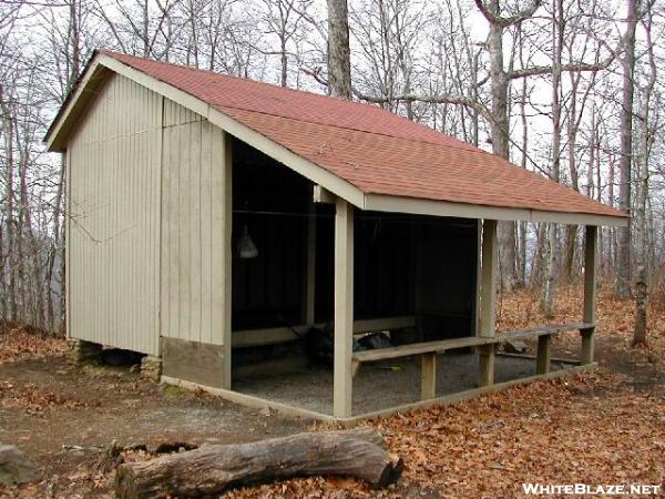
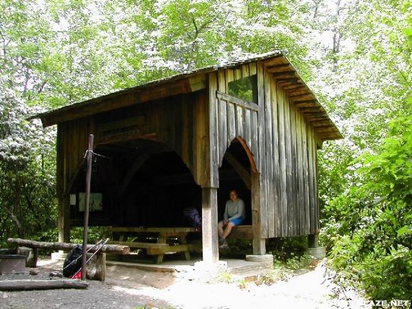
Depending on the weather, terrain and just how far I feel like hiking, there are plenty of shelters along the way.

After leaving Springer Shelter, the following shelters are along the way.

2.8 mile mark Stover Creek Shelter. An alternative if Springer shelter is packed.


8.1 mile mark is Hawk Mountain Shelter.


15.8 mile mark Gooch Mountain Shelter.


28.1 mile mark  Woods Hole Shelter  Requires a bear resistant canister to camp there.
mm 3.6 Woods Hole Shelter. GPS N34.7372 W83.9549  Courtesy pjwetzel@gmail.com

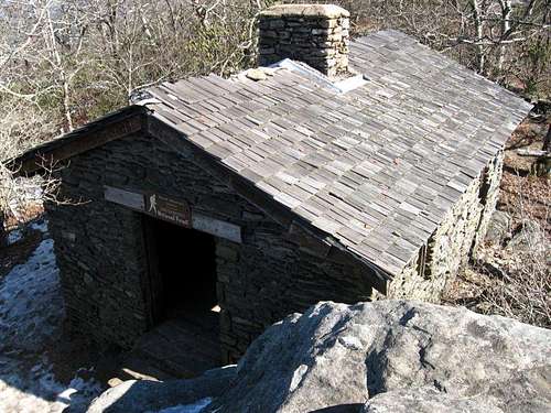
29.3 mile mark Blood Mountain Shelter.  Requires a bear resistant canister to camp here.
Blood Mountain Shelter from Abov

Historical building from 1934.

38.4 mile mark Whitley Gap Shelter


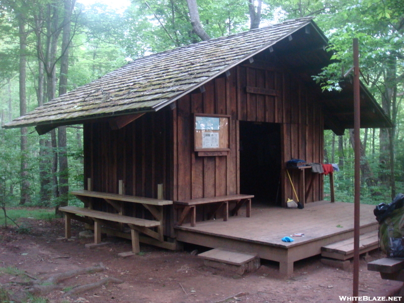
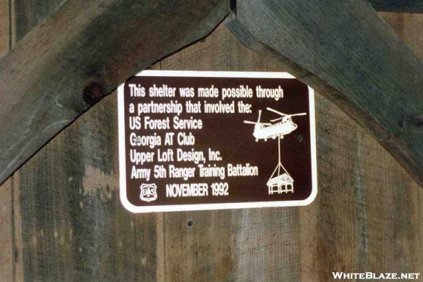
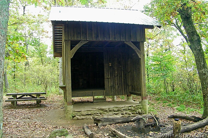
43.2 mile mark  Low Gap Shelter  built  up to be level.   Notice the Georgia style..


50.5 mile marker Blue Mountain Shelter


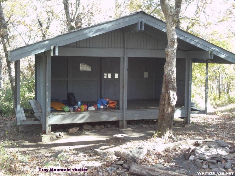
58.6 mile marker Tray Mountain Shelter


66 mile mark Deep Gap Shelter


71.4 mile mark  Plumorchard Gap Shelter


 Sign..


These shelters will lead you onto North Carolina..  at the 78.5 mile mark.


Springer Mountain

Here is where it all begins.. Sign in at Springer Mountain, Georgia. 3780 ft.  Chattahoochee National Forrest  Originally called Penitentiary Mountain for unknown reasons. Part of the Blue Ridge Mountain range.


File:Springer Plaque.jpg


The Appalachian Trail runs through 80 miles of Georgia.  The highest point is on Blood Mountain 4,461 ft.  Lowest point is at Dicks Creek Gap 2,675 ft.  


Along those 80 miles are many shelters for those of us who choose to stay on the trail.

Starting with Springer Mountain Shelter, it's where I hope to tent in the meadow my first night on the trail.   I begin in the morning to trek those 80 miles.  Hopefully, within a weeks time.


View from Springer Mountain


From Wiki:
Springer Mountain Shelter is located on a spur trail leading about 70 yards east of the Appalachian Trail. Blue blazes mark the spur trail. The trail junction is about 800 feet north of the brass plaque marking the southern terminus of the Appalachian Trail. The shelter has a raised first floor and a sleeping loft reached by a permanent ladder. Each level of the shelter can comfortably sleep four or five backpackers.
There is a fire circle and wooden picnic table in front (west) of the shelter. There is a three-walled privy down the hill directly behind the shelter. There is a piped spring about 30 yards (25 m) south of shelter. The spring has provided water even in recent drought years. There are two sturdy cables strung in trees near the shelter. Each is equipped with pulleys and hoisting lines for hauling backpacks and food bags out of reach of the local bears, raccoons and rodents.
There is a meadow with room for many tents near the intersection of the Appalachian Trail and the spur trail to the shelter. The meadow also has a fire circle.

It will be busy there the beginning of April.  I hope to get a tenting spot in the meadow that night.  My plan which will most likely change several times is to tent as much of the way as possible.  Hummingbird "tenting" the AT.. 


Georgia on my mind.. Amicalola Falls State Park

Welcome to Autumn!   It has been a very long while since I have written here.  It's getting close to the 6 month mark to take off!  I can't believe time has moved so quickly.  Yes, it will be here before I know it!

Good News!  I am now Ellie Baughman..  Rick and I have made that decision to become a married couple.  It's good.  The hike is still on and will have that added challenge of being apart.  A most difficult challenge.

Before I begin at Springer Mountain, I do plan to hike the Approach Trail in Amicalola Falls State Park. Named by the Cherokee meaning "tumbling waters".

The the Approach Trail includes the "Falls". Beginning at the Reflection Pond, with 604 staircase steps to the top of the Falls.  It's 8.5-miles to the Springer Mountain summit.   What a workout that will be to start on!  Ha.

I plan to spend the first night at the base of the Falls at the Max Epperson Shelter for thru hikers only.  That way, I can begin my hike early and get to the top of Springer Mountain to prepare for another early morning start. If I just can't make it to the top, there is the Black Gap Shelter 1.3 miles from Springer.

There is a visitor center for hikers to sign in and weigh their packs. There is also the "Arch" for that photo moment!


File:Amicalola-Falls Main Dawsonville-GA 01.jpg
Named by the Cherokee people, it is the beginning of the "Trail of Tears" when they were driven away to live in the Ozarks. 

http://www.southernhiker.com/wp-content/uploads/2008/12/img-1559.jpg


Tuesday, June 11, 2013

Good Morning..    I can't believe the time has gone by so quickly.  I've not been hiking as much as I would like to due to more work than usual.  That's not good but I do need to keep saving up for the hike.  My gear is looking good.

Made it to the REI members sale last Saturday.  I was in line at 5:30 with all the other eager members looking for a deal.  I got what I went for.  A pair of Merrill boots like the ones I have and love. Everything in the sale are returned items.  My boots were returned because they were too small for the woman who wore them once. $25.00.. an unbelievable price!  We all were allowed in the store in small groups at a time for only fifteen minutes.  What a scramble that was.. ha.  I went for the boots first and didn't see anything else that I didn't have already have.  No need to try and hoard things because of the price. 

I've been following the White Blaze and Trail Journal/forum sites everyday.  It appears that the rainy weather is causing the drop out of hikers.  It's been a wet year so far and may be "naturally" what it will be next year as well.  It doesn't rain much here (at least right now) but I would like to hike in the rain in my rain gear to see what it feels like with the extra bulk of a jacket and pants. Sharon and I got caught in a rain storm once on the trail.  We weren't dressed for it. got drenched and laughed about it once we were in the warm, dry car again.  There won't be any warm, dry car to jump into.  I hope that I will be able to keep my sleeping gear and inside of the tent as dry as possible.  I'll be looking for techniques that people are using that helps.

I'm feeling more positive about starting with the crowd in the beginning of April.   March starts may gain a little time, but that month later has to give a better chance of better weather.  Won't know until it happens.  Will need to learn some "sun" dances.. ha.

I hope to write more often.  I'm sure I will as time brings me closer and my excitement rises. I'm trying not to over talk the trail and drive people crazy.. ha.  It's coming up more often even if I don't initiate the conversation. 

Yes.. I'm going to do this.  God please guide me in my planning and the decisions I make. Though I am not a church going person, I do believe in God and that there will be times to ask for "strength" and times that the beauty around me can will bring God closer to me.

Hummingbird..  


Sunday, May 12, 2013

Happy Mother's Day 2013

Happy Mom's Day to all who are mother's to human children and to pets as well.  Being a dog walker,  I have had the fortune to know many pets who are as special as any child would be.

My celebrations with my children;  Sharon, Lou, Eric and Sina, will be today and tomorrow.  I'm looking forward to my special dinner!

My celebration with Rick was planting our vegetable garden with yellow squashes, purple eggplants, Japanese eggplant, green peppers, carrots, turnip, watermelon, honey dew melon, Swiss chard, radishes, butternut squash, zucchini, cauliflower, Brussel sprouts, cherry tomatoes and an already existing pumpkin plant (we believe that's what it is)  Ha..  I think that's everything.   WOW.. if it all grows in, we will have a feast in a few weeks. 


 I wish you all a wonderful day filled with love and sharing.

Indian Tribes that Lived and Traveled the Appalachian Trail

Cherokee - Georgia.. Amicalola Falls means "tumbling water".  Were driven away to the Ozarks.. beginning of the "Trail of Tears"

Cherokee- North Carolina. 

Penobscot - Maine  

State and National Forests Passed Through..

 Amicalola Falls State Park  8.5 miles, Georgia  Cherokee for "tumbling water".

Chattahoochee National Forest, Georgia   Cherokee for "flower painted rock". 

Animals, Insects Along the Trail

Mice-  Every State

Chipmunks - Maine

Banded Argiope Spider - Maine


Birds Along the Trail

Ruffled Grouse - Maine

Plants and Trees Along the Way.

I'm looking forward to the Natural Beauty of the Appalachian Trail.  It's wonderful to know what I will see and to be able to look up the plants and trees that I am not familiar with.  What a great bonus it will be to know something about the plants and trees that I will find along the way.  Those to touch and smell and those that are poisonous and should be avoided.  I can only imagine how uncomfortable a "rash" would be while hiking.

Rhododendron thickets

Blueberry thickets - Maine

Spruce , Red Spruce Trees -  Maine, 

Birch Trees - Maine

Azalea - Georgia

Redbud Trees - Georgia

Pink Azalea; Pinxter Flower Rhododendron  Very thick in Georgia.


Tiny Bluet, Small Bluet, Least Bluet  Bluets These tiny plants can be easy to miss when blooming single, but even with their 2 to 4 inch height, they're hard to miss with the frequent masses blooming together.


  White Oak Tree leave.  White Oak is a large tree, growing up to 100 feet tall.  The trunk can get up to four feet across. Leaves of the white Oak are four to nine inches long. Bright green on top and whitish underneath.


poison ivy in summer Poison Ivy.. BEWARE.. It's everywhere!


  Red Trillium They have been used traditionally as uterine stimulants the inspiration for the common name birthwort.


Mayapple or May Apple is native to deciduous forests  of eastern North America. The ripened fruit is edible in moderate amounts, though when consumed in large amounts the fruit is poisonous


Lichen varies and is a fungus found on trees as well as rocks throughout the trail. Disturbances causes it to die.  Best left alone though can be eaten. Yellow Lichen is poisonous.


Just how long is the Appalachian Trail?

This is a mystery question!   Ha.   All through the years there have been various miles quoted.  With our GPS technology now, we should have an exact distance.  With changes made in the trail since its creation, the distance has changed with it.   Here is what I have found in my research.

2,015 miles from "The Appalachian Trail" by Ronald Fisher 1972

2,155 miles from "There are Mountains to Climb" by Jean Deeds 1996

2167.9 miles from "Blind Courage" by Bill Irwin with David McCasland 1992

2179.1 miles from "The AT Guide" by David"Awol" Miller 2013 edition

Have you noticed it gets longer with time?  Ha..

Hiking Quotes

"To walk. To see. And to see what you see."   Benton MacKaye


History Along the Trail

In reading all the wonderful books I am finding, the history that is brought up and discovered along the way has made the stories so much more interesting.   I look forward to crossing these paths of history as I make my way North.  To know that people before me were in these places changing the course of our lives before we were even born and after.

I will record my findings following the map of the Appalachian Trail and welcome any additional information you would like to share.

Benton MacKaye dreamed up this idea of the Appalachian Trail in 1921. Myron Avery, chairman of the Appalachian Trail Conference worked 21 years helped make this dream a reality.    Because of all those who helped in this creation and maintain it even now, we are able to hike this trail today.  Thank you!

1925 the ATC  Appalachian Trail Conference began.   An organization for maintaining the trail through membership clubs. 

1948 Earl Shaffer completed the first thru-hike.

1968 the National Trails System Act was signed in.  Federal Protection for hiking trails.


Medical Issues

Reading through the forums and the books, there will be health and body issues to deal with while hiking.

I'm a diabetic type 2 and will be watching for ways to deal with this disease while hiking.  Fortunately I am not on insulin so that is a big relief.  Hiking and exercise does help to lower the blood sugar levels and I am hoping that this big hike will keep me at normal levels.

I am finding that IBUPROFEN is mentioned often for pain relief and inflammation.  It seems that they are taken in large quantities and often.  I wonder what the "overdose" level would be.

For myself, I take GLUCOSAMINE CHONDROITIN  everyday.  It is part of my daily vitamin routine and has made a difference in knee pain from an old injury.   I know when I stop it only takes a few days before I notice a dull pain in my knee.  I don't intend to leave home without it.

Bandages for blisters is recommended.
An Ace Bandage for back and leg pain.
Knee elastic support bands.

To be added to as discoveries are made.....


Saturday, April 27, 2013

"The Appalachian Trail" by Ronald M. Fisher

I've been laid up for the last few days with a "Flu".. I don't know what flu but one that made every muscle and joint ache.  My head and spine throb.  Most of you have probably experienced this at one time or another.   My daughter Sharon, nursed me to health with chicken soup, saltines, flu medicines and cola to sip on.  But even more, she covered my work so I could stay in bed,   Thanks Sharon! 

I decided that it would be a good topic to research in reference to the AT.  It is something good to know if you get hit by the flu or any other illness during the hike.

But I won't research it right now.  I'm starting to feel better and it feels good.  Instead, I picked up and read "The Appalachian Trail" by Ronald M. Fisher.  Published by  National Geographic in 1972. 


I do realize that the AT has seen many changes over forty one years but this book was still a pleasure to read.  It's full of history that happened along the AT.  That will never change. It changes the names on the map to places where important events took place.

The photography by Dick Durrance II is fantastic.  I would expect no less from National Geographic.

There are wonderful quotes on hiking that are worth collecting.  I'll make two postings that can be updated.  One to cover the history and another to cover the quotes as I learn more and more.

This hike will be more than just a walk in the woods..

Hummingbird "Nesting and Resting"...

Wednesday, April 24, 2013

Why would I want to hike the Appalachian Trail?

It's been a long while now since the thought was put into my head to hike that long trail from Georgia to Maine.  My friend Tom mentioned it and would tell me about a group who are planning to begin the hike in April of 2014.  They would all be over sixty years old.  I thought it was intriguing, but not something that I could do.  I would be sixty by then. hmmm..

It's funny how something will stick in your head and come to mind from time to time.  Actually, this thought has been coming up much more often than from time to time.  I began to read books and look up the Appalachian Trail online to find pages and pages of information sites.  The desire and fire to hike this trail has set in deep!

Why am I going to hike this Appalachian Trail?

Because I want to do something awesome for myself.  Because I will be sixty years old and still able to do it!  Because I hope that the beauty of the mountains will bring me closer to nature and to God.  That I will better understand and appreciate my life I have lived so far and what life has yet to show me.   

I'm going to hike the AT and I am going to be the one in four who makes it all the way from Georgia to Maine!


I have told people that I know, about this plan of mine.  I have had both positive and negative results. The two most positive and encouraging people I share my preparation plans with are my beautiful daughter Sharon Ann and my dear friend Annie Rose from far away in Australia.  Thank you both for believing in me. I love you both!

Rick, my love and companion, has been helping me to stay healthy and get in shape long before I seriously planned to hike the AT.  Our morning exercises and bicycle rides along the coastal path are great!  Though the hike isn't something Rick wants to do, he understands that it is something I need to do.  Thanks for sharing your research, your ideas and suggestions and learning just what the hike is all about!   Your support is important to me.  A valuable part of our relationship.

Others think it is crazy, strange or just something I will get over before the year is done.

Some may find they get caught up in the "spirit" of it as well.

I didn't know of Springer Mountain or Mount Katahdin, never mind the trail that extends between them.  What I did know of the AT as it is called, was that it ran through Berkshire County where my sisters and brothers and I grew up.  As a child no one talked much about it and it was many years later before I knew it wasn't a local trail exclusive to "us".

Appalachian Trail plaque at top of Springer Mountain.
 
Plaque at top of Mount Katadin


Now I have begun to prepare for this new journey.  My body, my mind, my budget and gear all need to come together.  I wasn't going to set up a "blog" but after changing my mind several times, here I am.  Writing down what I am going through during this year of preparation, will  help me keep track of what I need to learn and need to do to get ready.

Maybe it will one day help someone else who catches this dream to  hike the Appalachian Trail.

Already, I have hiked a twelve mile stretch in the woods.. The Temescal Canyon woods.  I didn't expect to do that for another month or so.  My shorter three mile hikes that I have been hiking several times a week this month, made me stronger than expected.   I climbed the three mile loop that rises a thousand feet in elevation and back down, four times.  It did take me seven hours to do that.  There were moments that I had to stop and rest a minute or two.  There were times when a "second wind" would take over and I would quickly hike up a steep stretch, surprising even myself!

In May, I will begin to carry my five pound loaded book bag around with me everywhere On hikes and off hikes. Anytime I am walking.  That will only be the first quarter of the weight I will carry for over 2000 miles.  I will not carry over twenty pounds.   I may have to write that down one hundred times to have it locked in my head.  

My gear collection is growing faster than expected.
GoLite Backpack.
GoLite Single person tent. 
Golite Sleeping bag.
Black Diamond trekking poles arrived today in the mail.

It's time to slow down and pace myself on buying the gear.   I would love to buy it all today and be ready.  That won't happen.  I will enjoy my treasures more if I get them one at a time.  I can write my list and rewrite it many times.  There is so much out there and so many opinions on everything needed.

I see that words flow easily here on these pages.  I'll need to pace myself here as well.  I do want to add pictures to breakup the rambling of my thoughts.  Heaven forbid I bore you!  Ha.
  
Hummingbird.. "Nesting and Resting"...
In the beginning...

 Every hiker chooses a trail name.  Some wait to find theirs on the trail, others like me, choose to choose a meaningful name before they begin.  I have chosen "Hummingbird". 


Legends say that hummingbirds float free of time, carrying our hopes for love, joy and celebration. Hummingbirds open our eyes to the wonder of the world and inspire us to open our hearts to loved ones and friends. Like a hummingbird, we aspire to hover and to savor each moment as it passes, embrace all that life has to offer and to celebrate the joy of everyday. The hummingbird’s delicate grace reminds us that life is rich, beauty is everywhere, every personal connection has meaning and that laughter is life’s sweetest creation.